Posts Tagged ‘Utah’

Back From Reality: Recompression

Tuesday, June 15th, 2010

After my trip to Utah, I got back, and spent an afternoon in Union Square to readjust to the city.

I call it recompression, because that’s what it felt like.

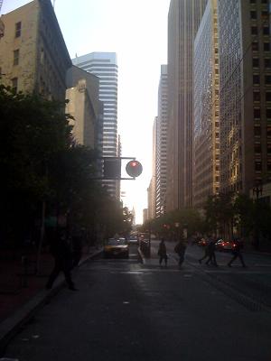
San Francisco City Street

The City Canyon in the morning

It was louder. There are a lot more sounds in the city.

Everything moves faster. It is harder to stop.

My good friend Tiven welcomed me back from reality when I got home from Utah, and he was right. While I was out in the middle of nowhere, walking amongst giant, strange, colorful rocks, and sleeping next to the Colorado River, I felt a certain realness about the place.

That realness was hard to find in the City at the moment.

I sat in the square for an hour or two, watching everything. Ate a sandwich. Talked to a homeless guy. I felt like a rock in a river, everything moving past me, things were gone before I even realized they were there.

The sound in the city is a cacaphony, a mixture of dozens of sounds, combines into a rolling jumble.

I started to think of the building walls as the walls of our own canyons, and the streets as the deep cut wash ways in between. The city is it’s own Fiery Furnace, it has it’s own Devil’s Garden.

Most of all though, it has people. People that flow through these canyons, scale the canyon walls, and climb the mountains. People carve this landscape, like the water carves the landscape of the desert.

That is the big difference between the desert and the city: people.

People shape this place, and people make the city what it is.

Without people, this city would be nothing but canyons made of concrete and steel.

It is people that make the city worth living in.

Ascending the Island In The Sky

Friday, June 11th, 2010

I spent last week in Utah, climbing and roaming around the desert in the middle of nowhere. These posts are about the things I saw, the places I climbed, and sometimes, the drawings I made. Previous day’s journeys include climbing to Angel’s Landing, weaving through Devil’s Garden, threading the Needles to Druid Arch, and Walking through the Fiery Furnace. This post is the conclusion.

From Friday, June 5

I packed up camp this morning. After today’s hike, I would head back home.

I had one more stop to make before I left, the Island in the Sky.

Island in the Sky is the northern district of Canyonlands National Park. It is named for the plateau that extends over most of the district, a thousand feet above the surrounding desert.

I hiked down, then back up, that plateau today. 1,300 feet, from top to bottom.

I went to upheaval dome. It is a large depression at the end of the large plateau that is either caused by salts dissolving under the rock, or by a meteor. I like to think that it was the meteor. Space is more interesting than salt.

I hiked the Syncline trail. It follows the plateau around the crater on the southeast side, then climbs down the mountain and circles the outer ridge of rock that surrounds the crater (or something like that). Then it climbs back up the mountain.

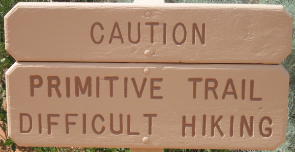
The trail had a stark warning: this was a difficult trail, but I eat difficult trails for breakfast. I wasn’t concerned.
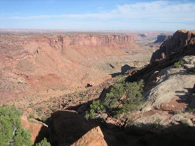
Syncline Trail from the top of the mountain

The view down the mountain. The valley below is all the way down, in the shadow of the rock wall.

The first half mile or so was flat, and an easy walk. Then I hit the descent.

I started weaving and moving my way down a rocky hill. After several hundreds of feet of descent, I came to a landing. I had a magnifiscent view of a valley extending out before me. I also had a view of the next 500 or so feet of descent in front of me. I got to work.

The climb down was steep, but it was early, and the morning sun hadn’t risen enough to beat down on me, I could climb in the shade of the mountain for most of the descent.

Eventually I reached bottom, and followed a canyon bottom for the next few miles. There was a touch of water in places, and some of the areas I walked through were quite lush with vegetation. Much more lush than I expected from the desert.

As I walked I started to think about my trip. I knew that I was hitting the road back to California when I got back to my truck — this was my last day in the desert.

The thing that I kept coming back to was that not much happened on this trip. I ate, slept, hiked, and drew. I snuck in a little reading in there, but not much. I didn’t have any great realizations, no spiritual discovery, not much of anything.

What I had was a blank slate. No requirements other than finding a campground and making sure I replaced the ice in my cooler every couple days. No agenda other than to move at my own pace and do what I had time to do.

In a certain way, the entire trip felt as if it was a long hike. Not a hike to any destination, but a process. A hike done not to go somewhere and see something, but a hike done to move through the world and feel the earth against my feet.

The last hike of my trip mirrored the trip itself. My last hike didn’t take me to a destination, like Angel’s Landing, or Druid Arch, or Devil’s Garden, or to the partition. It was a loop. I went from the top of a rock, to the bottom of the rock. I walked around the rock in a valley, then back up the rock. There was no destination or site to see, I went on this hike just to hike.

I can see clearly now, this was the reason for this trip. I didn’t go to find anything, to see anything, or to do anything. I was there merely to be there, and to exist out there for a short time.

There was no finding or discovery needed. Only doing was needed.

In my day-to-day life, I fixate on results, on destinations, on achievements. I never fixate on process. While I was hiking this loop, I could see that life is process.

Process can not be escaped, it can only be relaxed into, and embraced.

Sometimes the process will be taxing. In fact, I think that anything truly magnificent requires difficult work.

I came to the end of the valley and started to climb the mountain back up to the plateau. I climbed in the shade, which wasn’t a testament to how early it was, but rather how steep the canyon walls were. It started easy, and quickly became harder.

I had to pull myself over rocks, climb through narrow gaps, and push myself ever upwards.

The trail wasn’t always well marked, I had to blindly procede in a direction, trusting I would find the marker again to indicate the right path.

Sometimes I lost the trail completely. I had to track back to find my way again.

Sometimes, as I climbed, I had to turn down the hill, reversing my progress, to get around a large rock that I wouldn’t other wise be able to climb over.

By the time I pulled myself out of the valley, the sun was beating down on me, I was tired, and I didn’t have much water left. I reached a plateau, higher up than before, well above the desert floor. After a short distance, I found that this plateau was only a small ways up, I still had more mountain to climb.

The only course I had was to keep climbing. I put myself down into the desert, and I had to climb my way back up the mountain. At times I looked up to see how much further I had to go, other times I focused on my steps, one after the other, making sure my feet were in the right place.

I was worn out. I slipped more on this last climb than in all the other hikes I had done. I was tired, and I was thirsty.

Eventually, one foot after the other, I made it to the top. I pushed my way along the plateau back to the head of the trail.

The loop brought me right back to where I had started, tired, thirsty, hungry, this trail chewed me up.

I made to the top though, just like I knew I would.

I got in my truck, and drove home.
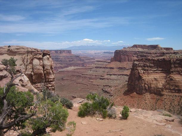
Syncline Trail from the top of the mountain

The view from the top of the mountain. Keep climbing.

When you find yourself on a mountain, keep climbing. That is the only way to reach the top.
Through the Fiery Furnace and the View from the Partition

Thursday, June 10th, 2010

Note: I spent last week in Utah, climbing and roaming around the desert in the middle of nowhere. These posts are about the things I saw, the places I climbed, and sometimes, the drawings I made. Previous day’s journeys include climbing to Angel’s Landing, weaving through Devil’s Garden, and threading the Needles to Druid Arch.

From Thursday, June 3

Fiery Furnace Arches National Park

The Fiery Furnace

Today was my day to relax. No 1,200 foot climbs up mountains, and no 11 mile marches through the desert. I thought I might wake up early this morning to hike out to Delicate Arch at sunrise, but that was not in the cards.

I woke up a little before sunrise, as usual. On this trip, I largely went to sleep when the sun went down, and woke up when the sun came up. For this trip, my bed was the bed of my truck, I never bothered to set up a tent, I didn’t really feel a need.

I also didn’t feel a need to light a fire at night. I did on the first two nights, but then never bothered to collect or buy wood after those first nights. When the sun set, and I had eaten dinner and cleaned up my dishes, I opted to lie in the back of my truck, and watch the stars emerge up in the sky, and feel the air cool. The air cools in discrete steps out here. The air would remain one temperature for several minutes, then I would feel a distinct and sudden drop in temperature by a few degrees.

Into the Furnace

I took my time in the morning, making coffee and cooking up eggs and chorizo. Today I would head back to Arches. I had a reserved spot in a guided walk through the Fiery Furnace.

The Fiery Furnace is similar to Devil’s Garden. It is made up of tall fins of rock closely packed together, creating a maze of canyons and passages. Access to this area is limited, it can only be accessed with a Park Ranger, or with a special permit, issued to people who have been into the furnace before.

The walk itself required a bit of climbing and weaving through narrow bits of rock, at times I had to wedge myself between closely spaced walls of rock and work my way through a crack. We only hiked about 2 miles through the furnace in the 3 hours of the hike, we stopped plenty of times for the Ranger to talk about how water influences the life and architecture of the desert.

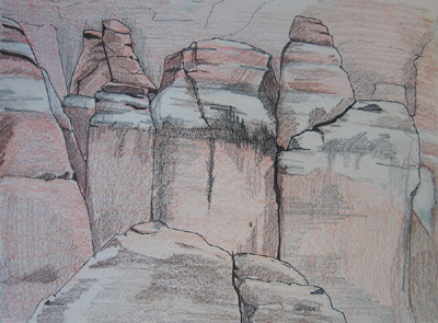
Fiery Furnace Drawing Arches National Park

Ink and Pencil Drawing of rocks in the Fiery Furnace (click to enlarge)

Interesting fact: If you need to refill your cantina, and come across a pool of water, make sure you draw water from the pool with the bugs on it, and the green algae growing at the sides. The crystal clear water probably has poison in it, that is why nothing grows at its side. The green, murky water is good enough for other life, it is probably good enough for you.

After emerging from the furnace, I plopped my down on a rock overlooking the area, and sketched up a section of the rocks that makes up the edge of the Fiery Furnace. It was hot, and the bugs were chewing on my relentlessly. The further along in the drawing I got, the faster I worked.

Afternoon at the Partition

After my morning in the Fiery Furnace, I had an afternoon to kill, and I headed back to Partition Arch. I walked by it two days ago on my way back from the Dark Angel, it is about half a mile to a mile past Landscape Arch.

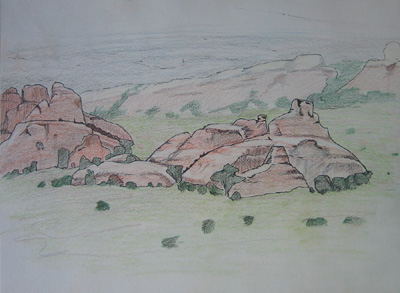
Devil's Garden Fins Arches National Park

Ink and Pencil drawing of rock fins near Devil's Garden (click to enlarge)

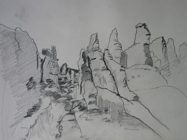
Partition Arch sits high up on a rock mountain, and has a nice open, sloped area underneath that looks out from the edge of Devil’s Garden to an open area of flat desert. In the middle of this open area is an array of rock fins, similar to the one I climbed two days earlier in Devil’s Garden, though these sit all alone.

For some reason these fins stood out to me, and I sat under Partition Arch for the afternoon to draw them.

Drawing rocks is like drawing faces. It is easy to put the elements in place to make the face I am drawing look like a face, but it is far more difficult to make the face look like the person I am drawing. Similarly, it takes effort to make the rocks I draw look like the rocks I am looking at. It is quite easy to make the rocks look like arock, but it takes much more work to make it look like that particular rock.

As I worked I started to think — in the personifying way man is prone to do – that the rocks each had a different personality. Some are quiet and reserved, some big and loud, and some sly, and maybe untrustworthy.

Rock Fins Arches National Park

Rock Fins, on the outskirts of Devil's Garden (click to enlarge)

I know that is not true at all, but I can’t help it. I am man.

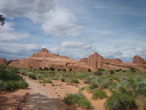
When I had enough of being bitten by flies, and I had eaten lunch, and I had finished my drawing, I headed back down the trail. On my way out, I took a small side branch that led down to the plain that the fins I had drawn sat on. I took a few pictures from the back of the fins, from down on their level (it’s possible I will do a woodblock print of these fins, in fact it’s possible I’ve already started carving the blocks).

The day slowly came to an end, the sun went down, I returned to my camp. I slept away, the last night I would spend in Utah.

Next: Walking the (Sync) Line

Threading the Needles to Druid Arch

Wednesday, June 9th, 2010

Note: I spent last week in Utah, climbing and roaming around the desert in the middle of nowhere. These posts are about the things I saw, the places I climbed, and sometimes, the drawings I made. Previous day’s journeys include climbing to Angel’s Landing and weaving through Devil’s Garden.

From Wednesday, June 2

This is what I came here for. By mid-day Wednesday I was miles from the nearest person, on the top of a rock, alone with the stone and the sun, looking up mountains and down canyons at the magnificent earth around me.

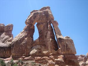
Druid Arch

Druid Arch, at the end of Elephant Canyon

By 7:30 Wednesday morning I was on the road. I learned from Angel’s Landing a few morning’s previous, and cooked myself a big breakfast of eggs and chorizo to start the day. Back in “real life”, I rarely eat because I need fuel. I eat enough to provide the energy for my usual daily level of exertion.

The desert is different. Climbing up mountains requires fuel, and I became aware of my need of food for fuel on this trip.

Fueled up, I hit the road. Canyonlands National Park is about an hour and a half drive south of Moab. I drove south from Moab for 30 or 40 minutes, then along the road into the park for about an hour.

Canyonlands National Park is divided into three parts by the Green and Colorado Rivers. The Green River joins the Colorado river in the middle of the park, and they continue on together. In the North is the Island in the Sky, which I plan to visit on Friday, to the West is The Maze, the labyrinth of rocks and canyons that is considered the most remote place in the contiguous United States.

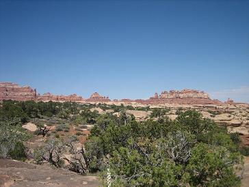
view from Elephant Canyon trail

The view just a few minutes from the Elephant Canyon trail head

I went to the Needles in the East, named after the rock formations throughout this area. They have been eroded in such a way that they bulge in layers, like soft serve ice cream poured badly, leaving a mound of lumps. These lumpy rocks stick up, resembling needles, hence the name.

A quick aside about Canyonlands: This park is far more remote than the Yellowstones, Zions, and Yosemites. There are no shuttles, no cafes, no plumbing, no simple guided tours. There is one road in to each of the three districts, and a small visitor center near the entrance. This park is not developed, and it is remote. Just what I wanted.

My hike started at Elephant hill, down the road through the Park, then down a dirt road for the last 3 or 4 miles. The trail immediately climbs up from the parking lot at the trail head. Within 10 minutes of walking, I was in the middle of nowhere.

The trail was easy enough to follow, thanks to the cairns (neat stacks of rocks) along the way. The trail took me up rocks, down through canyons, and along winding paths, until I hit the sandy bed of Elephant Canyon. A large portion of the trail is through this canyon, which serves as a wash during the sporadic rainy periods this area receives.

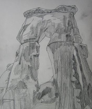
Pencil sketch of Druid Arch

Pencil sketch of Druid Arch

I followed the canyon until I neared the end, at which point the trail climbs up. The last bit of trail is a scramble up a hill of rocks, and it let out at a large open area of rocks, near the top of the canyon. In front of me was Druid Arch, standing 100 plus feet above me, jutting out from the surrounding rock wall.

I pulled out my lunch and my sketch book, and got to work eating a pear, an apple, granola bar, and plenty of water. As I drew, a raven slowly flew by, close to me, probably checking me out to see what I was up to.

I had this rock plateau to myself, nobody else made the hike out this far. I met a group of three girls coming back on the trail from Druid’s Arch as I was getting closer to it, but that was it.

Even more spectacular than the giant Druid’s Arch in front of me was the view of where I had come from.

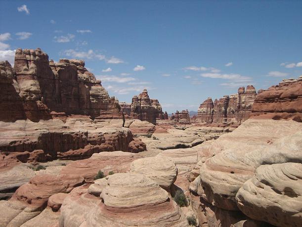
The extent of Elephant Canyon and the rocks of the Needles stretched out in front of me, as far as I could see. The trail that took me here weaved through the canyon below those rocks, taking me 5 miles into the Needles.

I sat up here for a time, letting the dry heat soak into me, and looking at this still landscape. The only sounds were the occasional rustle of a small creature in surrounding brush, the brusk blowing of the wind, and my own shoes rubbing on the rock.

The view of Elephant Canyon from Druid Arch

The view of Elephant Canyon from Druid Arch. Down below these rocks is the canyon I walked through to get here.

I started on my way back, working through the process of climbing down the mountain, traveling through the canyon, and walking up and over the canyon walls to the trail head. My feet were sore, I was thirsty, and I was ready to sit down, but that didn’t distract me from the process of hiking out this canyon. My usual anxiousness to arrive at my destination was absent, and I was able to enjoy the process of moving myself out of this rocky canyon, back to the trail head.

Worn out from the 11 mile hike, I got to my car, took off my boots, drank water, and drove back to my campsite.

I slept well.

Next: Through the Fiery Furnace and Pictures from the Partition

Dancing Through the Devil’s Garden

Tuesday, June 8th, 2010

Note: I spent last week in Utah, climbing and roaming around the desert in the middle of nowhere. These posts are about the things I saw, the places I climbed, and sometimes, the drawings I made. You can also read about climbing Angel’s Landing from the previous day.

From Tuesday, June 1

“This is the most beautiful place on earth.”

— Edward Abbey, speaking about the canyonlands of Utah, near Moab

I packed up camp Tuesday morning and started the 6 hour drive to Moab.

Dark Angel Arches National Park

Dark Angel, at the end of the Devil's Garden Primitive Trail loop

Moab is a small city in southeastern Utah about 3 miles from the entrance to Arches National Park. From what I can tell, the primary business is catering to people visiting Arches. There are restaurants, stores selling trinkets, and all sorts of “outdoor, adventure” themed hotels.

Just before Moab, I turned up the 128 to drive along the Colorado river and find a campground. I pulled into the first one I found, Goose Island Campground, pulled into the first available site along the river, paid my fees, dropped off a chair and tent, and headed for Arches.

By the time I got to the Park, it was late in the afternoon, about 3pm. Perfect time to start a long hike. I drove the windy road through Arches, past the paved lookout points and easy, 0.3 mile paved “trail” around Balance Rock, and finally got to the end of the road, Devil’s Garden trail head.

The first mile or so are an easy, well marked trail — essentially a developed dirt road. There may even be asphalt under the rocks, dirt, and sand along the trail. This ends at Landscape arch, and it is here that I went the primitive route.

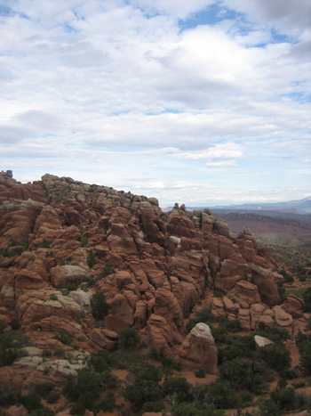
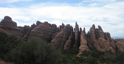
Devil’s Garden is named for it’s fins. The rock has eroded in to leave long, narrow, and closely spaced walls of rock emerging up from the ground. This leaves tall rock walls, with deep, narrow canyons in between.

It is not unlike a pod of giant rock sharks, with huge dorsal fins, swimming impossibly close together, just underground, with only their rock fins in layers of brown, orange, red, and white sticking up above the earth.

Devil's Garden Arches National Park

The outskirts of Devil's Garden

These fins captivate me in a way I can’t quite explain. I think it is a combination of their orderliness, their giant size, and their peculiarity that intrigues me.

The primitive trail followed a sandy trail away from the main trail, towards the Garden. Soon, I was coming to the outskirts of the fins, and detoured from the trail to walk up one of the fins.

The fin I climbed sloped gently from the ground, and I quickly made it to the high point on the far end. The wind was blowing hard, and I broke out my pad and pencil to sketch out the neatly spaced walls of rock that were in front of me.

I sat on top of this rock, drank some water, ate a granola bar, and worked with my pencils for half an hour or so before turning around to climb back down.

Devil's Garden Pencil Drawing

Pencil Drawing of the fins of Devil's Garden

Soon after I rejoined the trail, it led me into one of the canyons between fins, and before I knew it, I was climbing up, through valleys, over large rocks, scaling sloped rock walls, and generally working my way far back into the middle of nowhere while weaving my way through this rock garden. Climbing Angel’s Landing the previous day made me much more confident on rocks, and I leaped, climbed, scaled, and lifted my way through this magnificent Garden.

I had the trail mostly to myself, I only came across one or two other groups of folks on my way. The solitude was peaceful, and I was able to focus on my footsteps and push myself along at a reasonable pace. The Devil’s Garden trail ends at Double-O Arch, and meets the main trail out to that Arch, which I took back.

But first, I found an Angel.

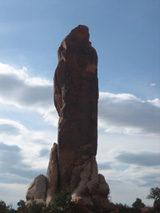
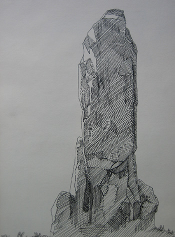
The Dark Angel is a rock about half a mile past Double-O Arch. It is a tall, dark, pillar of stone that sits out alone, not part of any nearby rock formation. I got to Dark Angel around 6pm, it was time to take a break. I got out my pad and pens, to draw the angel. I figured that if anything was worthy of breaking out the ink, it is the Dark Angel.

Dark Angel Ink Drawing

Ink Drawing of the Dark Angel

As I drew, flies, and other small, winged insects decided to repeatedly see how I tasted. I had to continually bat the flies from my face and arms.

Eventually, it was late, I was done drawing, and it was time to head back.

I took the main trail back from Double-O Arch, though it was about the same difficulty as the Devil’s Garden trail, just a shorter, more direct path. I made a few detours on the way, Navajo Arch, Partition Arch (which was so nice I would come back in a couple days), Pine Tree Arch, and Tunnel Arch.

As I walked back I thought about the Dark Angel, how it was so different from most of the other rocks out here. It sits apart from everything else, it is at the end of the most remote trail here. In a park of arches and fins of rock, it is a pillar, tall and erect, standing on its own.

I started to think of the Dark Angel as the mighty king of these canyonlands, and all of the Arches as his queens and concubines. I’m sure I can’t be the first to notice this obvious symbolism.

The sun was low in the sky when I got back to the trail head. I drank some water, and started the long drive back to camp. By the time I reached my camp, the sun had set, it was getting dark, and I was starved.

I made dinner in the dimming light, sausages and a can of split pea soup. By the time dinner heated up, I was using a flashlight to see what I was eating. I rolled out my mats and blankets in to the back of my truck, and went to sleep, under the stars, a dozen feet from the Colorado River.

Next: Threading the Needles

Angel’s Landing: Sunrise at the Top of the World

Monday, June 7th, 2010

Note: I spent last week in Utah, climbing and roaming around the desert in the middle of nowhere. These posts are about the things I saw, the places I climbed, and sometimes, the drawings I made.

From Monday, May 31, 2010

I watched the sun rise this morning from the top of the world.

My 4:45 alarm woke me up, I crawled out of my bed in the back of my truck. It was Pre-Dawn Monday morning, May 31. I was in Zion National Park. I fumbled to make myself coffee and pack up my camp in the cold and dark.

About a dozen people got on the first (5:45 am) shuttle up Zion canyon. I was half asleep when I hit the trail to Angel’s Landing, 3 other folks also hiked the trail, and pulled ahead of me. One set of switchbacks brought me off the canyon floor, followed by a mild walk through a small canyon, then another set of deathly switchbacks brought me up to the north rim of the canyon. A little ways longer, and I reached the turn off for Angel’s Landing.

Trail to Angel's Landing

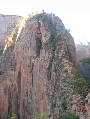
The last bit of narrow trail to Angel's Landing. The trail proceeds along the narrow fin of rock, then up the large mound to the top. There are a few folks starting the climb in the lower right corner

Apparently, this rock was named when whoever-it-was that named these things said, “only an angel could get up there.” Not a completely unreasonable observation.

Angel’s Landing is a mound of rock that sticks out into Zion Canyon, the Virgin River bends around this fin, a good 1,200 feet above the canyon floor. This mound is separated from the nearby canyon by a narrow fin of rock that dips down from the canyon, then up again as it nears Angel’s Landing. I got to the fin, and stopped for a moment.

This moment actually lasted quite a while. This narrow fin is, in some places, has no more than a yard wide area to walk on, and the plunge on either side does not stop for about 1,000 feet.

I sat at the top of this fin without crossing it – yet. The wind blew strong in this pass, and I planted myself down to wait for the sunrise.

The wind howled through this dip between the canyon and the Landing, I had to take my hat off to make sure it didn’t blow away. I sat there, watching the sun slowly peak up over the top of the canyon, and thought… nothing.

My mind was clear of everything, nothing raced through my head. I just sat and watched the light top off over the canyon wall, and begin to flood everything below with light. No mental breakthroughs, no grand philosophical or spiritual revelations, just… nothing. And it was glorious.

This narrow fin didn’t make me sure of my feet, or my knees, and I went back a bit to a nice landing with a view of Angel’s Landing. I pulled out my coffee thermos, an apple, and a pear, and had breakfast.

One or two groups made it up behind me as I started to sketch the mountain, and breakfast prompted me to keep moving. It turns out that I wasn’t sure of my footing, I just needed some coffee and fruit to fuel me up. The pass that looked incredibly difficult to pass was pretty easy, and I quickly got to the top, even though I was often one misstep away from a 1,000 foot plunge to my death.

Chain handrails have been added in places, and the climb to the top was half hiking, half scrambling up rocks, and half grabbing the chains and pulling myself up.

It was worth it.

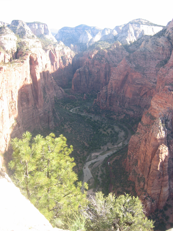
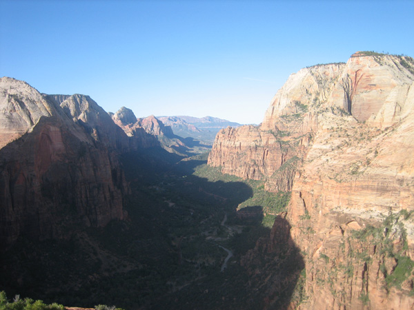
The top of Angel’s Landing is at nearly the same height as the canyon walls. I stood out in the middle of the canyon, well above the canyon floor:

View Up Canyon from Angels Landing

The view up Zion Canyon from the top of Angel's Landing

View Down Canyon from Angels Landing

The view down Zion Canyon from the top of Angel's Landing

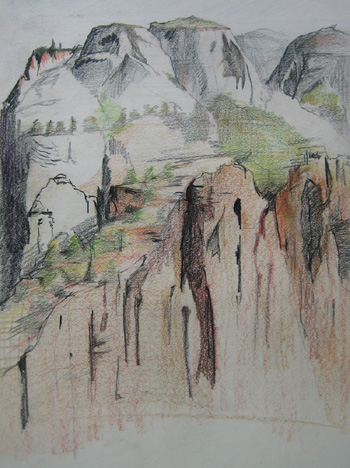
I pulled out my sketch book and worked on a drawing looking North from the top of the Angel's Landing.

Colored Pencil Drawing looking north from Angel's Landing by Sean Neprud

Looking North From Angel's Landing, color pencil drawing

I am fascinated most of all by the colors of this place, and how the mountains change colors as they rise up. The very tops of the mountains are light gray, almost white, littered with spots of green from the trees growing high up there. As they get closer to the canyon walls, the rocks are more of a brown color, until you hit the sharp fall of the canyon wall, and the rocks are a rich red brown color.

I stayed on top of the Landing for a good hour or so, then started the scramble down. Going down was easier than the scramble up, I had become far more sure-footed by making my way to the top.

New hiking boots with good traction help quite a bit. Over this trip, I learned to trust my boots to pull me up, over, and around all sorts of rocks. I learned to trust that they would stick to the rock when I needed them to. My boots would become invaluable to me over the next week.

In many very real ways, I trusted my boots with my life, and to keep me from serious injuries. In many of the places I would go over the next week, my boots were all that were between myself and pain, major injury, and — in the case of today — certain death.

I made it down, worn out, ready for a big breakfast, and with a clear head.

Next: A trip through Devil’s Garden to the Dark Angel